SouthernXposure.com.mx

Climbers, Eco-resort Owners, Mountain Police and the Bridge Between Us and Them.

Pena de Bernal from Chichi’dho

When it comes to tourism Peña de Bernal is the focal point for all of the State of Queretaro in Central Mexico. As far as climbing destination it is the focal point for all of Mexico and the World as there are very few areas that are similar. At just over 1,900 feet tall Peña de Bernal is the tallest free standing monolith in the World. For the town of Bernal it attracts tourists from all over who desire to hike the Memorial Trail and spend time in one of Mexico’s most eclectic towns.

This is a story of the new incoming administration that controls the monolith, eco-tourists ascending the via ferrata, climbers and the rappel line traditionally used to get anyone spending their day on the wall back to the ground safely.

When two cultures collide:

A little background information on the Monolith~

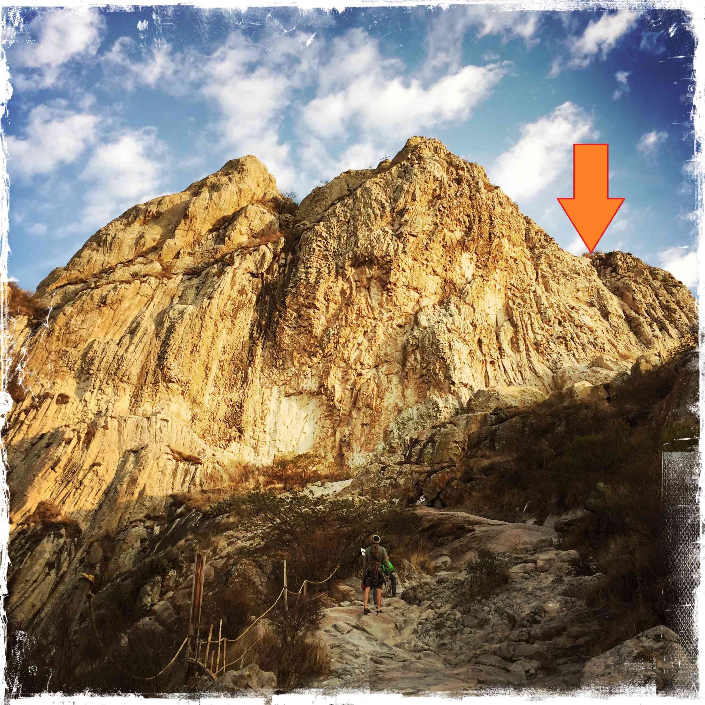
Way back in 1920 there was a Via Ferrata constructed on La Peña to allow visitors an unobstructed view from the top of this majestic pinnacle of the valley below. The orange arrow delineates where the classic rung route ends, and where climbers would naturally rappel when the climbing day has been concluded.

The classic Memorial Trail hike. Well worth visiting Bernal just to do this short thirty minute approach for outstanding views of the valley below

So as climbing, and tourism gained in popularity so did the number of visitors to Bernal. There are roughly ten multi-pitch climbing routes that summit the monolith and a plethora of variations to gain the main lines to the top.

Peña de Bernal. Great stone, and equally superb routes.

The Via Ferrata has seen much commercial success over recent years as the ease of ascent and subsequently descent gives many more people not prepared to climb technically access to the summit. So on any given day we have a mix of climbers and commercial Via ferrata trips at the rappel station up top waiting to return to the ground. All the while tourists are happily frolicking sixty meters below. This influx of summit visitors has eroded the upper descent trail that deposits everyone at the main rappel station high above the hikers below. Honestly, this trough from the summit trail leading to the anchor chains was never really set up from the beginning to handle traffic and this issue could have easily been remedied, but as you will read is all part of the story.

The 1920’s Via Ferrata, and clients simil-rapping the descent trough. The pristine quality of the Porphyritic Granite is spectacular for technical climbing.

Part 1: My return from the states.

So within a short time of returning to my home in Mexico I ventured over from my town of Aculco (ninety minutes south) to the shady side of the monolith to visit my good friend Fernando. This is where our adventure begins.

The shady side of the monolith is home to Chichi’dho a beautiful eco-tourism camp and hostel for adventure travelers. The Landin family owns the property and has been slowly transforming the area to a magnificent landing for any traveler who finds themselves in the state of Querétaro.

Whenever I guide the monolith Chichi’dho is where I choose to stay. Not only because of the natural setting and tranquility but for the friendship I have built with the Landin family. They are fantastic people who have a vision for the property and México as a whole. Young Fernando being a great friend and always has sage advice whenever I have questions regarding the people and culture of such a beautiful country is always a pleasure to spend time with. To know Fernando is to like him.

If you find yourself in the state of Queretaro and you enjoy the outdoors, visit Chichi’dho. This eco tourist resort.is setting standards way ahead of its time for preserving land for the future within the country of. México.

On this particular visit Fernando actually had been waiting for my return so he could explain to me how the the town of Ezequiel Montes (overseers of the monolith) were rumbling about closing the area for climbing as they saw no real benefit of this user group vs. the rock fall threatening tourists where the Via Ferrata deposits anyone going vertical back on the ground. The tourists were being put in the path of projectiles being kicked free from visitors (who know nothing about being cautions with rock fall) descending the via ferrata with a commercial guiding group. This descent is by far the easiest as you can start routes anywhere on the monolith climbing upwards for up to eleven pitches and grab the ferrata rap for one easy 65 meter rappel with two 70 meter ropes tied together. After climbing eight hours or more a 30 minute rap is really nice.

Ezequiel Montes wanted the rappel moved out of the area so anyone on their way down wouldn’t put hikers at risk.

Move the rappel? This would be a huge logistical undertaking to say the least…. The monolith is about 2,000 feet tall and not all of it is vertical. Having multiple steps on the wall would complicate matters as would trying to clean an entirely new retreat. Holy cow! There has got to be a better way?!

Fernando, his brother Omar and I met with the representatives from the town and I implored them to clean the existing line as the debris laying in wait was the issue and it could be remedied so the via ferrata visitors wouldn’t create more issues. Nope. My pleas fell on deaf ears…. They were convinced that a) it was climbers not via ferrata people, and b) that this is what they wanted and there would be no further discussion. Well….. I figured poking a nest of bees never turns out well for the one holding the stick so we best appease the powers that be and figure it out.

The red arrow being the via ferrata, the orange arrow being the [agreed upon] location of the new rappel and the green arrow is where the rappel ended up happening. Keep in mind that the wall under the green arrow is +- 800 feet tall.

The red arrow being the via ferrata, the orange arrow being the [agreed upon] location of the new rappel and the green arrow is where the rappel ended up happening. Keep in mind that the wall under the green arrow is +- 800 feet tall.

So after much discussion we agreed with the town to move the rappel to the very left of the memorial ledge to keep people below out of the path of falling rocks and also minimize the added strain on via ferrata traffic. Keeping in mind that for people not familiar with being around vertical cliffs; going up in one location and returning in another is much more complicated for everyone involved. The climbers? Well… realistically getting down is all part of the experience so a bit more of a rap wouldn’t be too cumbersome.

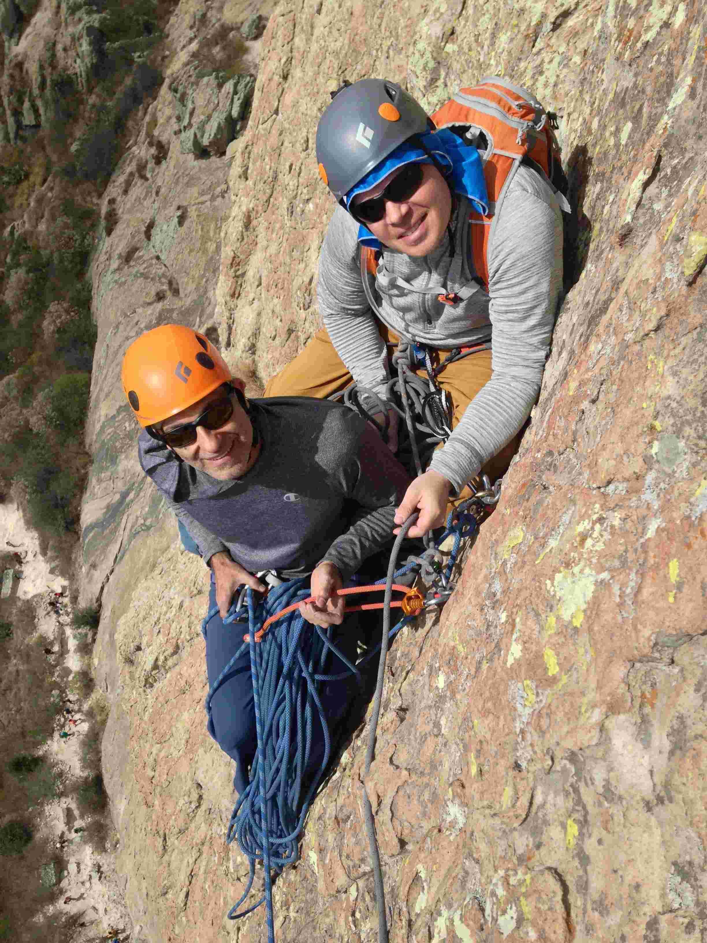
On our way up to the top. Eight of us in total. Five climbers and three people from the town.

What went on from the ground where we all agreed on the new rappel location to the summit of the monolith is still a mystery to me….

When Fernando reached me at the high rappel anchor he looked at me and said “plans have changed”. I was like what, huh? What plans? He proceeded to tell me that along the path up while climbing the metal rungs one of the main gentlemen from the town (who was free soloing) told him they wanted the location to be further left. Like, much further left…. I was in shock. Now we were all up top and we would have no idea where to stage the rappel looking down. So I went and found Jerry Daniels who was (equally involved as any of us) trying to figure out how to pull all the pieces together. I said “Jer, they want the rap way further left than we agreed on the ground”. He looked at me and got a blank stare as he knew we were now 2,000 feet up and just willy-nilly rappelling could get ugly and time consuming (as we were both on borrowed time from our daily lives). “What? Huh? No. No. Why? Who told you this?”. I said Fernando had a conversation mid-climb with the “mountain dudes” and laid it all out for him (the abridged version) from what I got from Fern.

Fernando and I talking about all the unknowns below us.

Fernando and I talking about all the unknowns below us.

Fernando, Jerry and I talked to the representatives from the town and walked around at the summit for quite some time trying to figure out where exactly would be agreeable to the town. No more vague answers or unknowns as this was a serious undertaking and the work involved was going to be extensive. Almost like looking for water with a divining rod. They pointed and we tried to find a path of least resistance back to the ground. This time I was a little wiser and said well…. one of their guys is going with us. Everyone looked at me like I was nuts. Taking a person who never wore a harness down a fixed line to who knows where? Yeah well, we need answers to where they want the rap, no second guessing…. someone is joining us. Octavio was the town’s choice as neither of the other gentlemen would even consider it (this after they all free soloed the iron rungs).

Octavio and Omar getting ready to start the rappel.

Octavio and Omar getting ready to start the rappel.

We decided as a group that Jerry would go first and set anchors and I would handle all of the safety aspects of keeping all of us on the ropes and moving smoothly. This was going to be quite the adventure and without working together the entire plan could fall apart. Once an anchor was installed (with extra bolts to spread out the group) Jerry would communicate that it was safe to move our group 30 meters down a vertical cliff one rappel at a time.

Octavio headed towards what would be the new rappel line on Peña de Bernal. I love it when people absorb and follow directions. He understood where we were going and kept his hand on the brake like a seasoned climber.

Staging the next rappel.

Staging the next rappel.

Adventure to me is getting involved in the unknown. Jerry handled the drill and hardware, Octavio pointed the way, Fernando kept a clear line of communication encase something went awry, his brother Omar kept an eye on Octavio to make sure he didn’t do anything to endanger himself and I kept us moving safely down the line. Adventure at its best!

From left to right: Simeon Heimowitz, Fernando Landin, Octavio Urima, Jerry Daniels, Maikel Rosabal, and Omar Landin

From left to right: Simeon Heimowitz, Fernando Landin, Octavio Urima, Jerry Daniels, Maikel Rosabal, and Omar Landin

The day went really well for not knowing what to expect. Octavio had an adventure of a lifetime and we established a new rappel line that would keep the climbers separate from the via ferrata while subverting any further issues with Ezequiel Montes and the mountain police. Two cultures that don’t understand one another found a way to work together for the better good of all.

At this point were we done? Not by a long shot…. The entire rappel line needed to be meticulously cleaned and a ledge had to be built at the top of the third rappel anchor staging point.

Omar, Joren De Smet and I building the grand traverse ledge.

Omar, Joren De Smet and I building the grand traverse ledge.

We returned a few days later to secure a ledge system that would survive the test of time. As I explained to the group; if we don’t build the support structure the new rappel line will soon be worse than what people originally used on the via ferrata.

The finished product.

Public service. is a service intended to serve all members of the community. This project was a union of climbers, a local business and the county seat of Ezequiel Montes. Every part making up the whole.

Jerry and his lovely wife Annette supplied the hardware to make the anchors a reality. Omar, Fernando and Joren from Chichi’dho supplied the wood and wire to create the ledge system. The fine gentlemen from Ezequiel Montes, aka The Mountain Police helped carry all the materials to the base of the rappel so we could set up a haul system. We all worked together to make this project become a reality while creating a solid relationship between the climbers and the people who oversee the well being of the monolith.

We all gained from this experience and we are all better because of it. At first I was very hesitant to get involved with a project of such magnitude especially when it involves the local government. I am glad that I saw the entire process through as now I have a better understanding of the culture of the people here in Central México and have successfully built bridges between the climbers and those who oversee the mountain. Building bridges for the future.

Climbers and driving in México. The secret BETA.

Screenshot border.png

It’s no secret that the climbing scene in Mexico is exploding. A burgeoning middle class South of the Border has fed a boom of outdoor adventurers to the likes never seen before in the history of the country. With this exodus of climbers and alpinists moving into the great outdoors comes copious amounts of information via social media. New, beautiful and exciting areas are popping up all over the country just waiting to be visited. With the generous exchange rate on the dollar, endless new areas, new routes to fall off of, ample amounts of warm sun, and an abundance of delicious food all combined with the ease of driving around makes habitating South of the frontera quite desirable.

So if you or someone you know is headed south on vacation, or better yet has sold off everything they own, bought a van to live in, and has pointed said cabin cruiser towards the land of the never ending sun this post may come in very handy. Within the body of this blog is a good insiders list of how to cross over and make your way around a country that lives by a different set of rules.

Let’s start our journey before your journey actually begins.

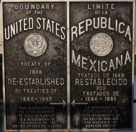
Here are two things you need to understand before you even consider crossing the Rio Bravo. One; you need a permit solely for your vehicle. This permit adheres to your windshield and *MUST BE RETURNED WHEN YOU EXIT THE COUNTRY. This permit is Mexico’s way of knowing you aren’t planning on selling your vehicle while visiting. The second and equally important piece of information is about covering your ass. Car insurance in the US only covers the US. Buying a rider policy to piggy back your existing coverage is easy and not expensive.

The vehicle permit is attained in one of two ways. The first which I highly recommend is going on-line and applying for the permit through Banjercito https://www.banjercito.com.mx/registroVehiculos/#

The process is made really easy and the bank sends the permit to your house (usually within two days) via DHL. This is a huge step in the process of crossing over smoothly. It is also entirely possible to attain the vehicle permit at your point of entry into Mexico but be sure to have two copies of your vehicle title, registration and passport (of whoever’s name is on the vehicle), as well as the originals in your hand when you walk in. If your vehicle is leveraged, ie a bank loan it is a good idea to have a letter from the note holder saying it is okay with them for you to leave the country with the vehicle. This way you will not be required to have the title on hand. In the last few years the nice folks only asked for my registration and never any talk or requests for the vehicle title. Is this the norm now? I don’t know… Just be prepared as anything can happen in Mexico….

In either case having your vehicle permit, or applying on the spot you need to enter “Aduana”, otherwise known as the immigration building upon arrival for a tourist visa. As you need a visa to travel freely in Mexico you have to visit immigration. In one case, with the vehicle permit already affixed to your windshield you are in and out in less than ten minutes and the other….? Well…. depending on your fluency with the language and fellow travelers traveling in either direction, this will dictate how fast you move through the process. As a side note~ Always get the six month travel visa. If asked how long you will be visiting~ standard answer…… drum roll please…. six months. You have no idea how many times people plan on staying two weeks and end up driving around with an expired visa. In Mexico it is pretty hard to get entangled with the police. They are super laid back and pleasant. If you are asked for documentation and your visa is expired, all bets are off. Don’t cause yourself undue stress. Get as much time stamped as you can. Honestly, even six months goes by quickly.

The next tip is do your homework on reinsurance. Not all companies are created equal. Check your current coverage limits. Mirror those limits of liability, and get a blanket policy covering your travel dates. If you get into an “accident” as this is exactly what they are and there are injuries, you want to be covered. If you aren’t everyone involved will be on you like a pack of Zombies similar to The Walking Dead. Only this won’t be a Hollywood set……

I have used the same nice people for years to help me with my coverage. Here is a link to their website www.motormexico.com Erica is super knowledgeable and can tailor your policy to your specific needs.

So now that we have the vehicle taken care of let’s discuss a bit about what can make the driving in Mexico that much easier. Google Maps is undeniably a great tool to help with the navigation, distances and time between points of interest. But this tool will only be helpful if you have a solid connection which leads me to connectivity. Before you make any assumptions on cell service once you’ve crossed it is best to contact your service provider. All companies, and plans are not created equal. You absolutely want to call your provider and tell them about your plans to visit Mexico and how long you are planning to stay. Ask about fees related to usage. Make sure there aren’t any surprises as far as daily usage, or 24 hour caps on data. Another option is buying a Telcel chip for the phone and changing the service entirely once inside Mexico. A Telcel chip usually runs about $6 American dollars and you can expect to pay $20 a month for phone service and data combined. The pluses of Telcel is the cost and connection. As all US companies don’t have agreements with Mexican cell towers there could be dead zones. Telcel has the country blanketed and connectivity is normally solid. The minuses are with the chip comes a Mexican phone number. My advice is downloading WhatsApp onto your phone. https://www.whatsapp.com/ This way connecting with your contacts is seamless and calling between country codes is negated.

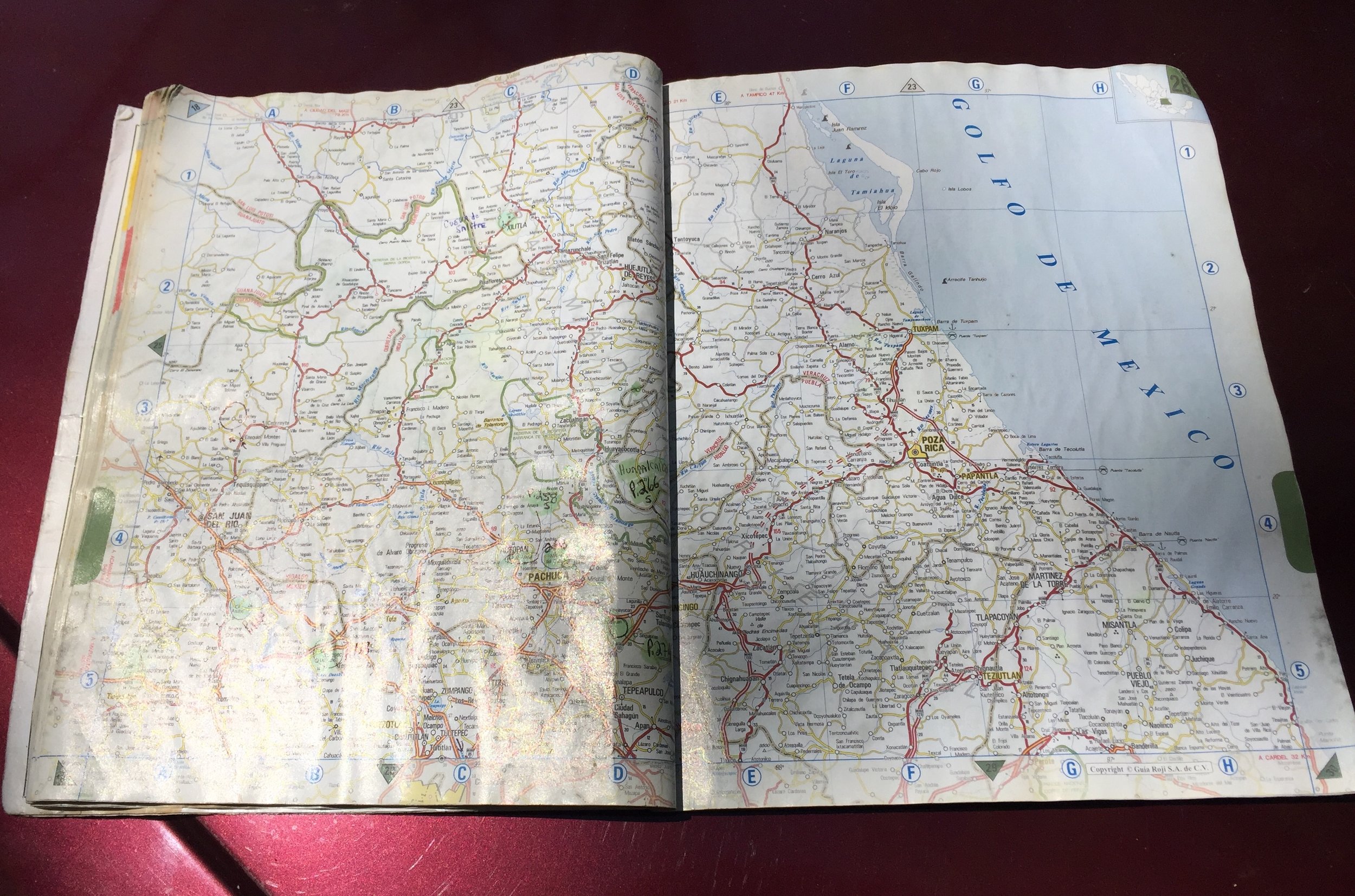
With connection comes the ease of point to point navigation. Google Maps is really great but take my advice and pick up a map book of the entire country by Inegi. http://en.www.inegi.org.mx/

Inegi Maps are worth their weight in gold when asking for directions.

Inegi Maps are worth their weight in gold when asking for directions.

There are several reasons I write that having a physical map is a really good idea. Mainly having a map in your hands helps because it gives you the big picture of where you are headed and where you came from. If passing a huge metropolitan area the map will show the pay roads leading around the city, as not to pass directly through. Also having a map in your hands it is possible to see if your route passes close to any National Parks or historic destinations. As a rock climber and professional guide I bought the newest edition of Inegi’s country map book and cross referenced every climbing area in Mexico with the two book climbing guides for the country. Guidebooks for Mexico.

This is the Southern Book. It is best to buy both the North and South as a set.

This two book set is worth every penny, and will be a great compliment to the map as between the two it is easy to find a climbing area traveler’s may not even know exist, let alone being close to the route being navigated.

There is a State line between these climbing areas. Pay close attention to geographic locations, as well as areas listed in the guide books.


Lastly as a travel companion pick up The Lonely Planet for Mexico. https://www.lonelyplanet.com/mexico This book is really detailed with national heritage sites and out of the way destinations most people have no idea even exist. These extra resources are worth having as the journey is much more important than the destination. The planning process is also very exciting and will help put all the traveling into perspective so you will not miss any secret spot off the beaten path.

Now that the vehicle is tight and the navigation handled let’s cover another oversight that may become a stressor. Planning on bringing Fido or Fluffy along for the trip? Bringing the family pet is absolutely possible, but before the dog loads into the family truckster here is a bit more key beta. Get your dog(s) a new collar, and inscribed tag for Mexico. Name, email, phone number and write ‘reward’ on the tag as well. In Mexico anyone finding a dog with reward written on the collar will absolutely, positively, contact the owner. Family pets have a way of becoming “Mexified” as soon as they cross over. They stop listening, stop behaving and have a tendency to become much more independent in there new found country. Having REWARD printed clearly, a US number with the country code, a Mexican number and an email address is inexpensive security, and peace of mind.

The next key beta is having your vet email all your vaccination records for your pet. Entering Mexico is a breeze, but getting back in the US could be tricky if you get a pissed off Border Patrol agent. I’ve been traveling from Mexico back into the US every year since 1997 and only ran into problems on one occasion where border patrol asked about my dog. Having all your veterinary records is a good idea.

The next item you want to have covered is buying a Seresto flea and tick collar for your dog.

https://www.chewy.com/s/brand_facet:Seresto?gclid=CjwKCAjwk7rmBRAaEiwAhDGhxAsVHchdCV8ia3R0cEf8EBS-xZYii7KOUJJ-3JYnEUJAEIbRjJAwAhoCbgAQAvD_BwE

Mexico, and a few of the southern border states have a tick borne disease called Ehrlichiosis. https://en.wikipedia.org/wiki/Ehrlichiosis_(canine)

The spot works good, but ticks still jump on the animals fur for a ride. Something about the seresto collar makes the animal invisible which keeps the ticks off thereby preventing contamination of living areas. The thing about Ehrlichiosis is that people are susceptible to it as well. I’m sure my point is clear.

Now the vehicle is packed, the dog is in and you are headed for the border. Let’s cover border crossings, and the pitfalls of where you cross. Depending on where you live will dictate the easiest point of entry into Mexico. A few words to the wise; be very cognizant of where and when you cross. Christmas, New Years, and Semana Santa are the biggest travel weekends encompassing the frontera. Crossing over anywhere near these Holidays can make a ten minute jaunt in and out for a visa into an all out saga. In Laredo, Texas it can take hours just to get into the parking lot of Aduana, let alone inside to handle the documents. The best way to handle this is to plan ahead. Crossing early in the morning is a good idea. Also using lesser traveled ports of entry is recommended. One such location is the Columbia Bridge northwest of Laredo, Texas. https://en.wikipedia.org/wiki/Laredo%E2%80%93Colombia_Solidarity_International_Bridge

Columbia Bridge is a hidden gem for frequent or infrequent travelers to Mexico and is wholeheartedly recommended by me, a person who has spent many an hour in the vortex of international crossings. You will know you are there when it is you, a few of the Mexican authorities and a whole lot of nothing else. It is super quiet and relaxed when crossing (unlike lots of other bridges). The only hiccup is in 2016 the Texas Highway Authority closed the manned toll booth on the road to Columbia and put in an electronic pass system. TexasTag is needed to pay the toll. The secret beta for this is if you do not have TxTag; call them, open an account, and deposit five dollars. https://www.txtag.org/en/home/index.shtml

Once the crossing is done and you are inside the trade zone of 65 miles from the border be sure not to speed. Drive chill and get to the nearest pay road (Cuota) for wherever you may be traveling. The Texas crossings all lead to Route 85/85D which is the pay road. *Note~ the toll collectors do not take American dollars! You need to have pesos to get onto the highway. Why do I write specifically to take the pay roads? Safety. Simply said going the free road (Libramento) will detour through every small municipality and the road conditions with be less than desirable. The pay roads in Mexico are very reasonable, they are in perfect condition and by paying if you break down there are free roadside mechanical services that meet you on the shoulder. Once South of Saltillo, Mexico the pay road is 57D all the way to Ciudad de México.

The driving thru Mexico is outstanding. Once South of Saltillo and over the initial mountain range the drive is spectacular. Try to time your departure and mountain crossing for dawn’s early light. This way once you enter the big valley and the Desert of Chihuahua you can experience the grandeur of traveling thru Mexico.

One last piece of advice….. the police in Mexico. So as in every developed Nation there are really great, friendly police and the predators. Mexico is no different minus the fact that when you get yanked over North of the Border the decimal place is moved steadily to the right and everything gets worse the more you talk. In Mexico if you get pulled over the first rule is “it’s Mexico!” and chances are you will be checked for proper documentation and given a handshake then gone. If by chance you are in a position to have to pay for a trumped up charge be smart. First; if you know you are being shaken down don’t panic. Have you ever gotten a fat ticket in the US for doing nothing? This will not be the case. First piece of advice, and this is a big one! ONLY HAVE $200 PESOS IN YOUR WALLET! Put all your money somewhere else. If the police tell me I’ve done something wrong, and I know it is bunk I first tell them, “Oh, you must be correct.. let’s go down to the police station and discuss this with your superior”. The first proper shake off. If this doesn’t work I deny the charges, and insist I follow the policeman down to the station as written above to discuss this with his commanding officer. Nine times out of ten this will get you unsnagged, and free to go. If the policeman says you have to pay right there pull the “Jersey Juke” on him and crack your wallet in his direction showing only the $200 piece and give him the bright pleading eyes, “this is all I have”. This will get you going for a $10 dollar donation. Much less than you would EVER pay Stateside…..

Well, I hope this blog post comes in handy for anyone pointed South with grand adventures planned. If you find yourself North of Mexico City drop me an email and come check out the local climbing scene that is second to none in all Central Mexico.

My Guide Service is SouthernXposure and you can always reach me via email. If you need any secret beta on new areas, or how to locate the best camping I can surely help.

If you like this blog write a comment and let me know. If I missed any secret beta write; as together we can make everyone’s travel in a country with few strict rules that much more special!

As they say in my neck of the woods,

Bien Viajes!

Simeon